Import Maptek Data
The Import Maptek Data feature allows users to import slope stability monitoring radar data from the manufacturer Maptek.
To import Maptek data:
- Select File > Import > Import Sensor Data > Import Maptek Data.
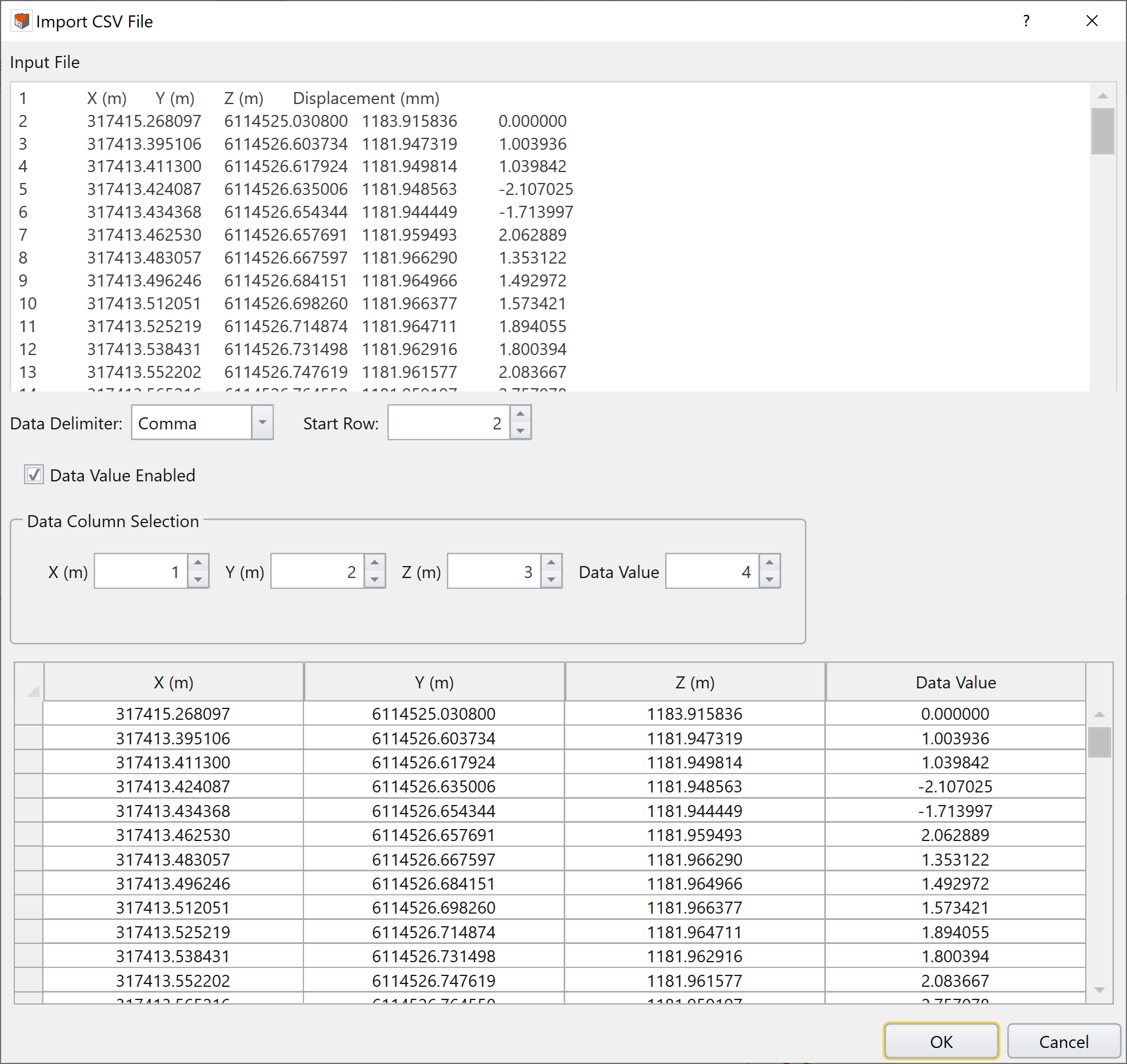
- Opening the .txt or .csv file of interest will prompt the Import CSV File dialog to open.
- Comma,
- Semi-Colon,
- Space,
- Tab,
- Pipe,
- All.
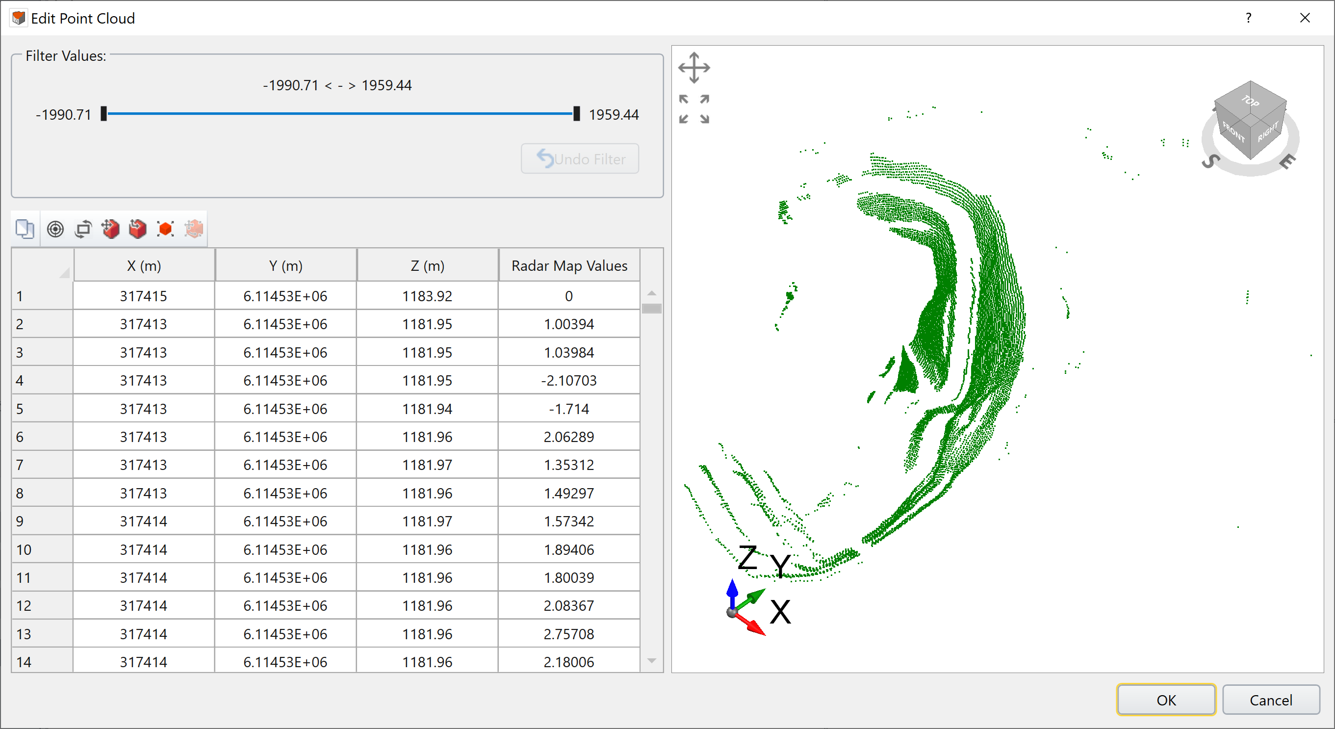
- The Edit Point Cloud dialog will pop up.
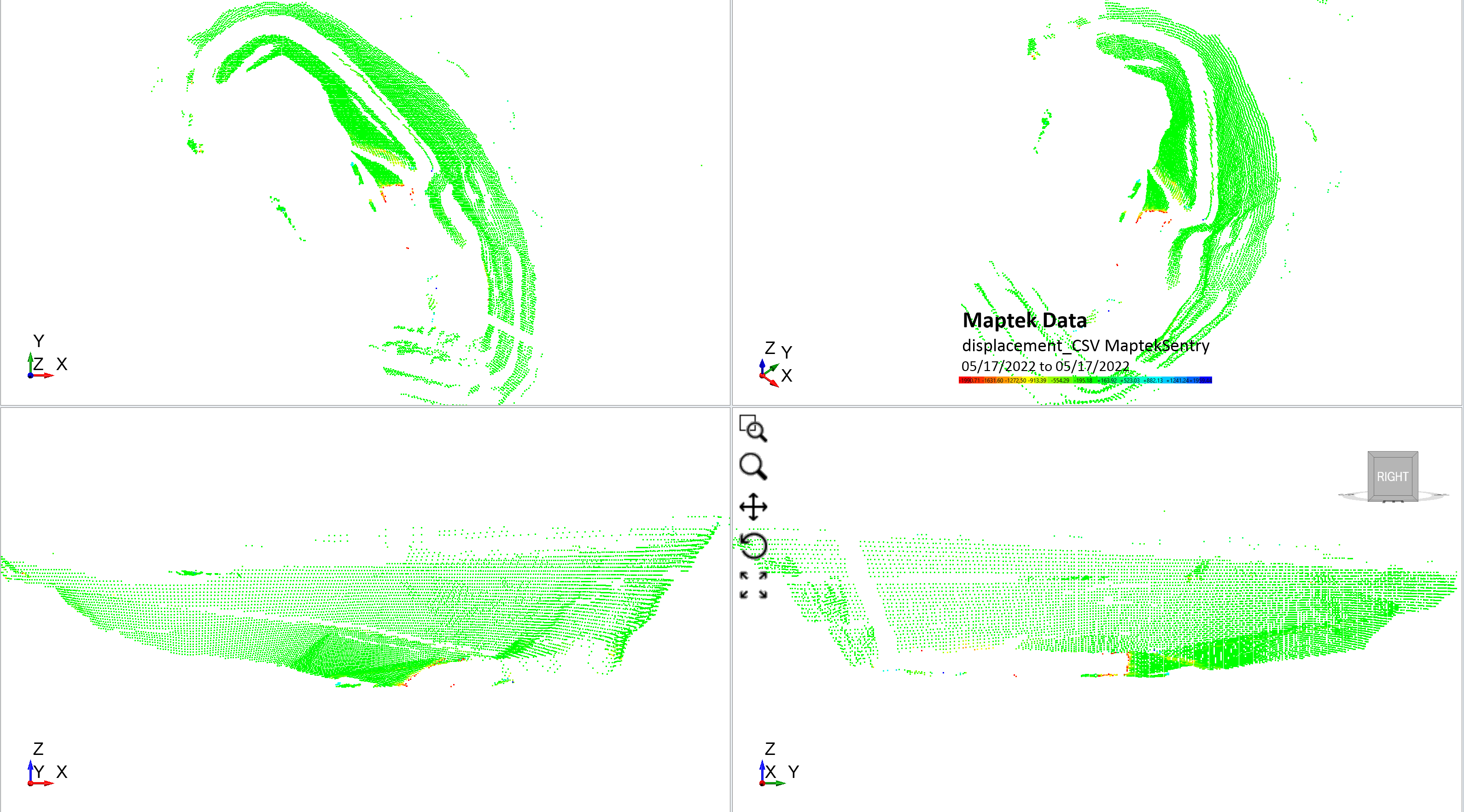
- Click OK to render the Maptek displacement data in 3D as shown below.

The user can customize the method with which the program sorts through the data by selecting the type of Data Delimiter from the list below:
The user can also change the Start Row. The Data Value Enabled option allows the user to display data at each (X,Y,Z) coordinate. Some data imports only require coordinates while others like IDS radar data include a data value for each set of coordinates. The data can be anything, depending on the tool that uses the dialog. Even with the same manufacturer, like IDS, the data type can change (not just displacement), depending on what's in the file.
In the Data Column Selection section, the user can select which columns from the source file are displayed. If the values from the table represent the X,Y,Z coordinates of the radar data, click OK to proceed.

The user can now see a preview in the viewport on the right hand side of the dialog. An example dataset from Groundprobe is shown above. You can use the viewport to rotate the model to confirm the geometry matches the project location.

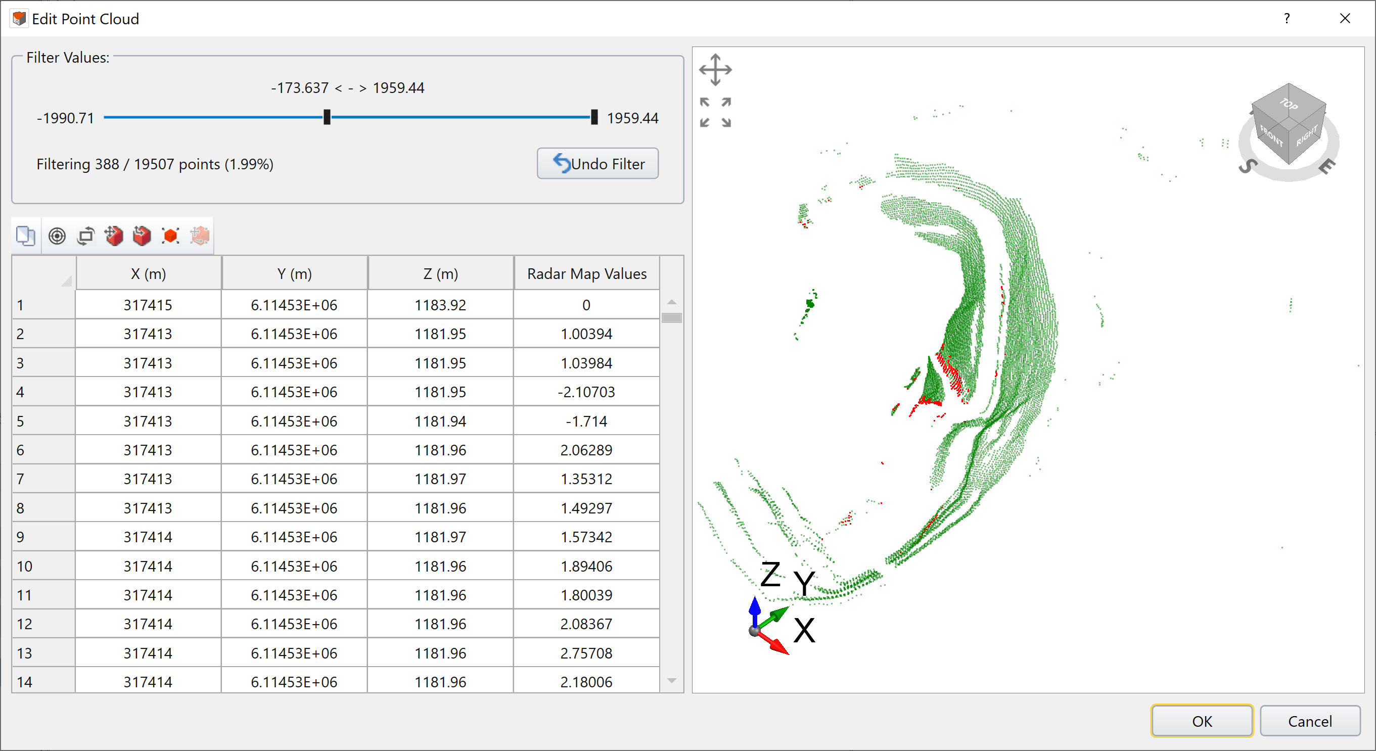
The filtered points, whose value is out of range, are rendered in red color (see above); while the unfiltered ones are in green color.
