RocTunnel3; Your New Software for 3D Underground Rock Stability Analysis and Design
Looking for a more intuitive way to model complex underground geometry? It’s about to get easier with RocTunnel3, our revolutionary new 3D block stability analysis program designed specifically for complex underground rock engineering applications.
Typically, 2D limit equilibrium methods have been used for analyzing structurally controlled failures in underground rock excavations, but assumptions need to be made for the geometry, loading conditions, and failure mode.
RocTunnel3 instead uses a comprehensive 3D limit equilibrium approach, which enables staged block stability evaluation and support design in potentially complex geological domains. It ties together modern field data collection and computing, all presented in Rocscience’s familiar and user-friendly interface.
With RocTunnel3, You Can:
Conduct deterministic and probabilistic block stability analysis: Find valid blocks formed from intersecting joints and calculate the factor of safety of each block in a deterministic analysis. You can sample rock unit weights, joint shear strengths, and water pressures across multiple simulations to calculate each block’s failure probability.
Design supports and staged excavations: Analyze block stability and the required support pressure and support depth in every construction stage for meeting a user specified design target. Design shotcrete, support pressures, and bolts in stages to address the challenges of structurally controlled failures underground.
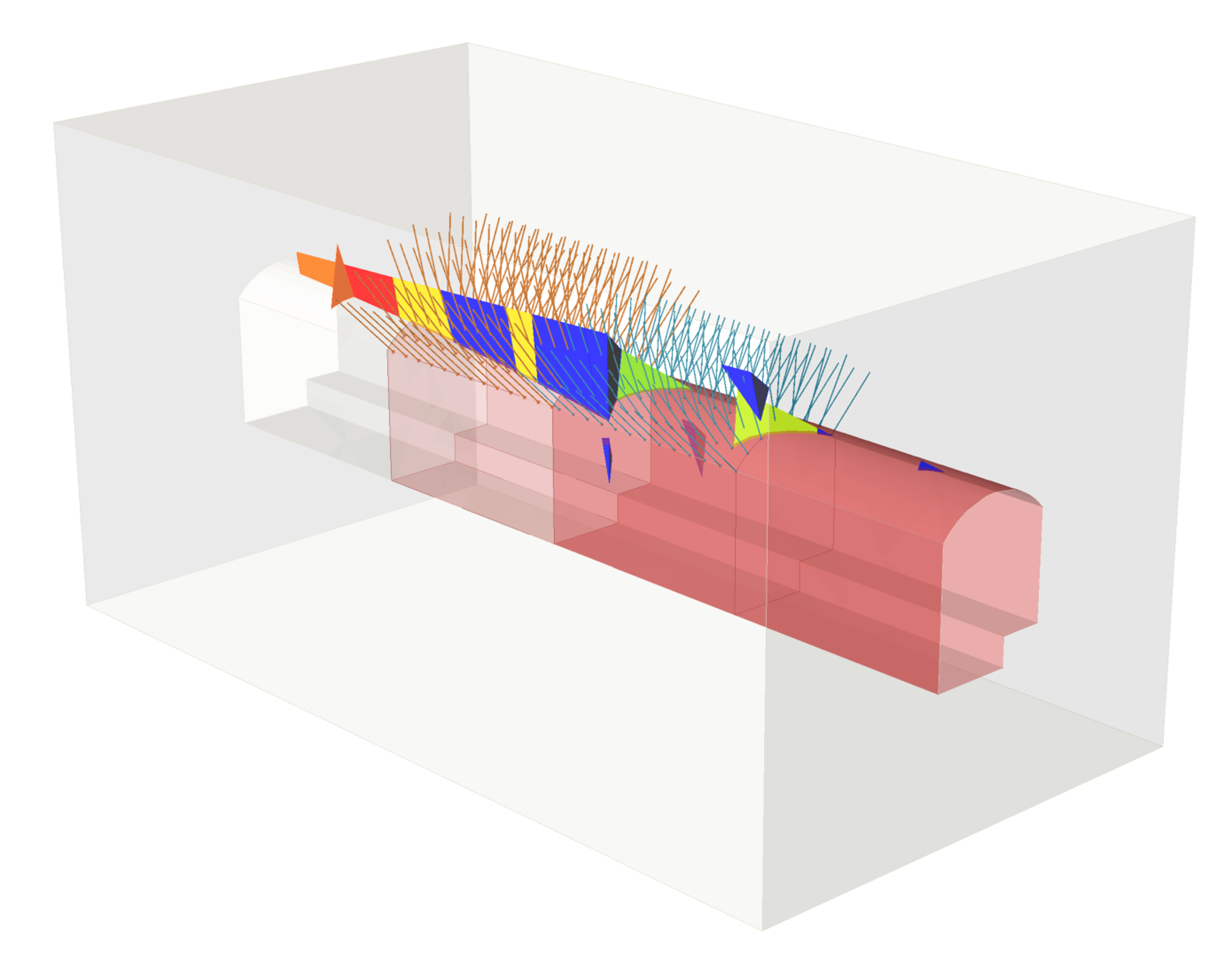
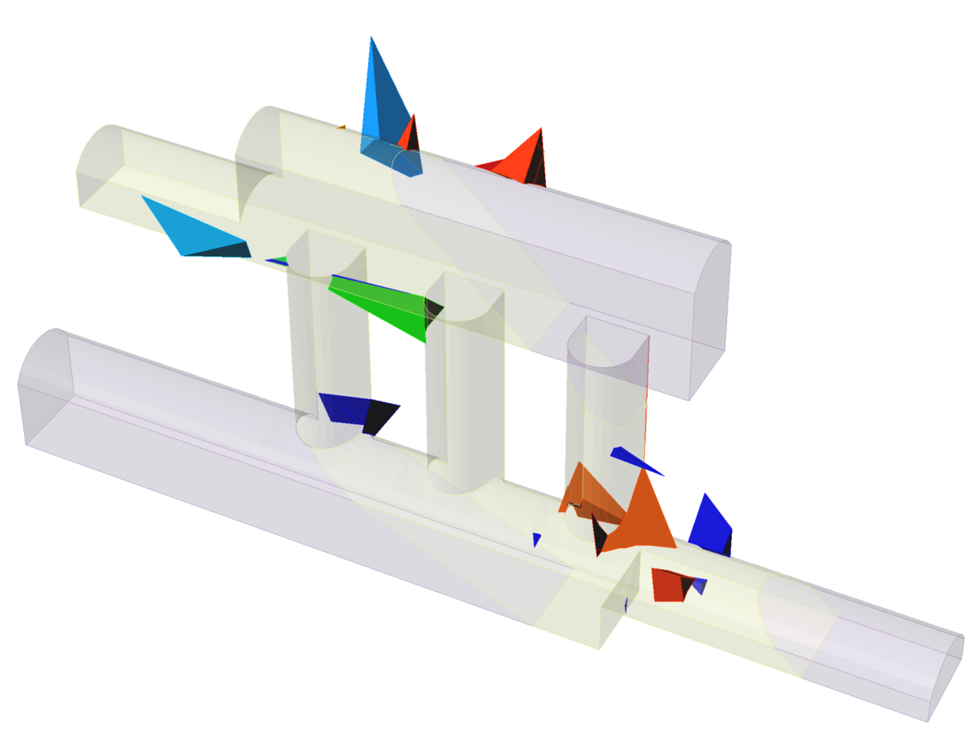
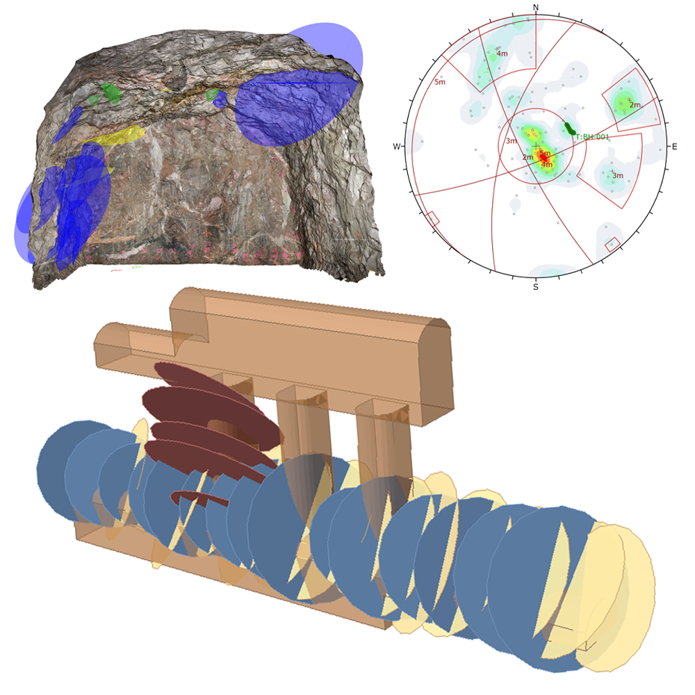
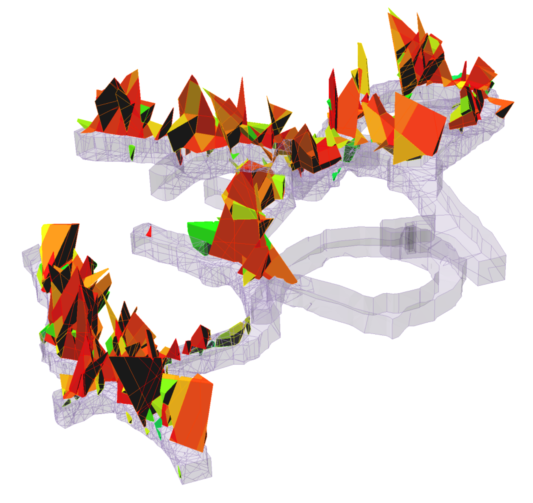
Model 3D geological structures: Model realistic 3D underground excavations in complex geological domain and easily import and update geometry and joint field data. You can also export geometries of the excavation, blocks and block failure information.
RocTunnel3 in Action
Below are just a few of RocTunnel3’s practical applications:
Tunnels: Assess and locate block failures in staged construction, design liners, and reinforcements for safer operations.
Underground mining: Locate and assess block failures at multiple scales after blasting. You can characterize block failures from natural and excavation-induced joint sets, analyze required support capacities, and design your reinforcements.
Underground energy and storage facilities: Analyze the geologic hazards of underground facilities, including seismic loading in complex geological domains. Easily update your model with new survey data and perform probabilistic block stability analyses for safe long-term operations.
Complex 3D Modelling, Simplified
RocTunnel3 shares the same user interface and workflow common to all 3D Rocscience products. If you have used RocSlope3, Slide3, or RS3, you already know how to construct models. In fact, you can directly import geometries from these programs without needing to reconstruct.
Additionally, if you are an existing user of RocSlope3 and DIPS, then you know the user flow for importing joint geometries and the mechanics behind the block stability analysis. The only difference now is a setting that is underground rather than on a slope, and with the added feature of model staging.
Watch the Trailer
Get a sneak peek at the software here:
FAQ
How is RocTunnel3 Different From UnWedge?
Both products use the limit equilibrium method for assessing underground block stability. However, key differences lie in the modelling of geological structures and geometry.
UnWedge is 2D assuming ubiquitous joints whereas RocTunnel3 is 3D utilizing discrete and finite joints. This means RocTunnel3 can provide insight into the location of block hazard, which is important for risk mitigation and opens opportunities for value engineering. Additionally, utilizing a full 3D model in RocTunnel3 allows for the explicit modelling of geological complexity, excavation alignment, and staged construction.
Users can quickly analyze any change in the hazard and support requirement with the progression of construction. RocTunnel3 can import UnWedge files, providing users with the opportunity to extend existing projects to 3D.
How Much Will RocTunnel3 Cost?
Whether you’re working solo or in a team, we have multiple lease options available. See the following chart for details:
License Type |
Price |
Personal Cloud Lease |
$6,499 |
Flexible Cloud Lease |
$9,999 |
Flexible Lease (Local) |
$14,999 |
What Else Do I Get Out of RocTunnel3?
- A hazard map of block instability via deterministic factors of safety or probabilities of failure of blocks for every construction stage.
- Key block analysis and total failure volumes controlled by key blocks.
- The required support pressure and support depth in every construction stage for meeting a user specified design target.
- Support design using various bolt types, shotcrete, and support pressures in staged installation.
- Direct integration with DIPS and UnWedge.
- Exportable model, block geometries, and block information.
Where Can I Learn More?
We have a library of learning resources for RocTunnel3 available to support you, whether you are a practicing geotechnical engineer, an academic or a student. See them here:
Transform Your Underground Rock Engineering with RocTunnel3
The geotechnical industry is evolving with the adoption of modern mapping technologies and faster computing. RocTunnel3 captures real 3D excavation geometries along with discrete joint data, all processed and computed in feasible times.