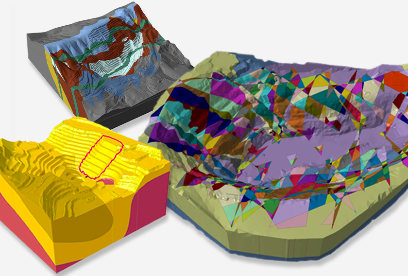
Seamless Stability Analysis Starts With Our Newest Integration: ShapeMetriX and RocSlope3
Introducing a smarter way to work. With the latest update to RocSlope3, you can now directly import 3D models and mapped joint data from ShapeMetriX.
Designed to make your workflow seamless, this powerful integration takes you from field data to advanced slope stability analysis with ease, so you can focus on what matters most: delivering reliable results. Here’s how RocSlope3 and ShapeMetriX now work together in your geotechnical analysis workflow.
What is ShapeMetriX? Meet Efficient 3D Modelling and Mapping
ShapeMetriX is a powerful software suite designed for high-resolution 3D modelling and fast, detailed, non-contact geological mapping. This makes it ideal for structural mapping in inaccessible or unsafe areas during fieldwork. It simplifies complex workflows with three standout components:
- MultiPhoto: Transforms overlapping 2D images from drones or handheld cameras into detailed 3D models. By integrating externally surveyed Ground Control Points (GCP), these models can be georeferenced to a superior coordinate system.
- ModelEditor: Generates 3D models from existing E57 laser scanner or OBJ geometry datasets and allows you to trim and confine the 3D model to the area of interest.
- Analyst: The ultimate tool for visualizing and assessing 3D models. Easily map structural features, measure joint orientations, and evaluate rock mass characteristics at a fraction of the time spent on the field. With features like semi-automatic trace and area mapping, discontinuity modelling and automatic joint set clustering, Analyst makes geological assessments faster, safer, and more reliable.
The recent addition of E57 laser scanner and OBJ geometry data import ensures compatibility with cutting-edge data acquisition methods.

RocSlope3, 3D Block Stability Analysis Made Efficient
RocSlope3 takes the complexity out of 3D block stability analysis. From rock slopes to excavation faces, RocSlope3 allows you to easily simulate jointed slopes and blocks, predict potential failure zones, and calculate factors of safety.
Now, with this latest release, RocSlope3 and ShapeMetriX give you a direct line from field data to actionable insights.
The New Integration Brings New Features: Import ShapeMetriX Geometry and Joint Data
The new ShapeMetriX import features allow users to directly upload:
- 3D Geometry: Import detailed models of rock faces or slopes as RocSlope3-compatible files (.3grs).
- Joint Data: Upload mapped joint orientations, locations and trace lengths (.3gdps) for block formation and failure assessment.
This integration minimizes manual effort and ensures that every step — from data collection to analysis — is smooth and connected. Engineers can work with data straight from the field.
From Field to Analysis in a Few Clicks
By combining ShapeMetriX’s 3D model generation and mapping capabilities with RocSlope3’s analytical power, engineers can now streamline the entire stability analysis process:
- Field Data Collection: Capture aerial or terrestrial images of rock surfaces using drones or handheld cameras, or you can use existing laser scanner datasets.
- 3D Model Creation and Structural Mapping: Generate 3D models and map structural features in ShapeMetriX.
- Data Import: Transfer geometry and joint data into RocSlope3 for analysis.
- Analysis and Results: Conduct 3D block stability analysis to identify potential failure zones, calculate factors of safety, and design support systems.
Case in Point: Open-Pit Bench Face Analysis
A project from the ShapeMetriX–RocSlope3 Integration Tutorial shows the potential of this workflow (see the tutorial for the full details). The study analyzed a 15-meter-high, 90-meter-long open-pit bench face, focusing on stability and failure mechanisms using ShapeMetriX and RocSlope3.
In ShapeMetriX’s MultiPhoto module, 49 drone-captured images were processed into a 3D model. Structural mapping in Analyst identified and mapped 503 joint surfaces, with detailed measurements of dip, dip direction, trace length, and location, which were then exported as RocSlope3-readable files.
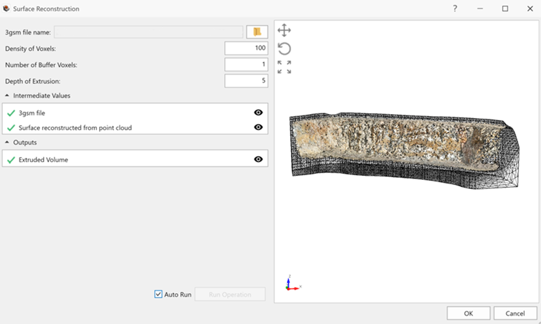
The 3D geometry file (.3grs) was imported into RocSlope3 using parameters like Density of Voxels set to 100 and Depth of Extrusion set to 5, creating a high-resolution model of the bench face.
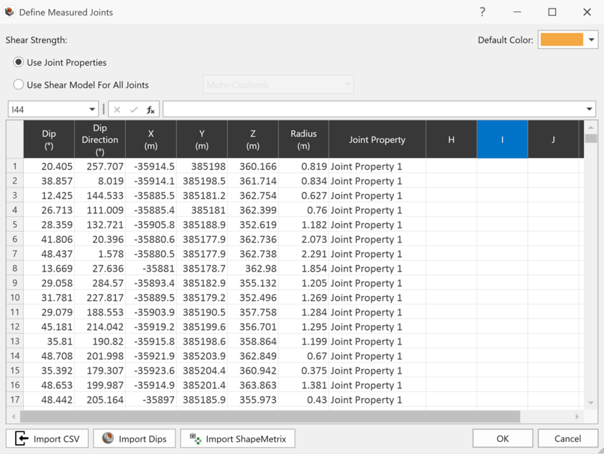
The joint data file (.3gdps) was then imported, providing detailed joint orientations and properties for block stability analysis.
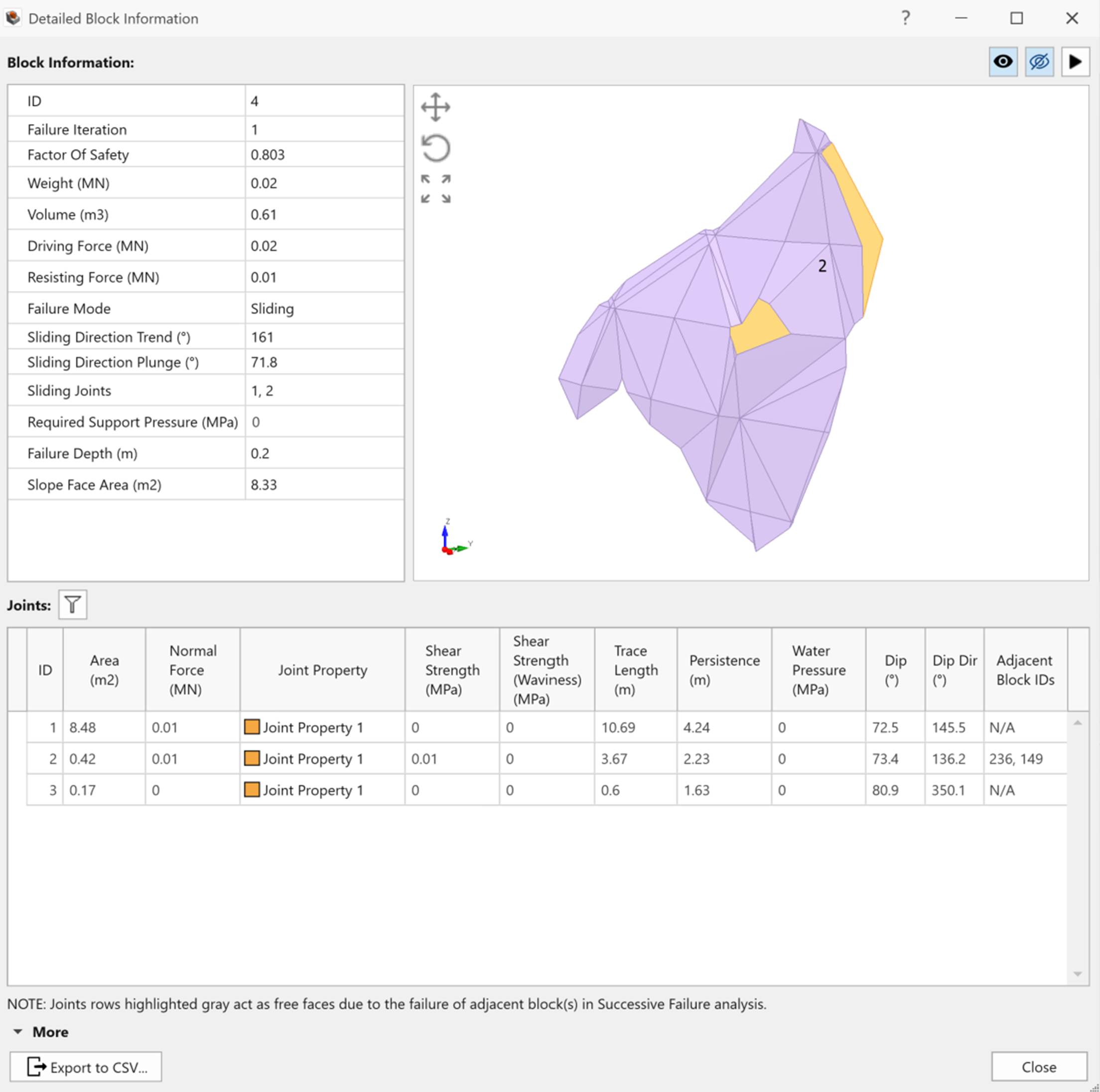
During the analysis, RocSlope3 identified 112 removable blocks, with 54 blocks showing factors of safety below 1.0, indicating instability in certain sections of the slope. Being able to identify locations of block failure is a hallmark of RocSlope3 and 3D block stability assessment. Successive failure analysis simulated how blocks detached over several iterations, revealing 40 key blocks and cascading failure mechanisms.
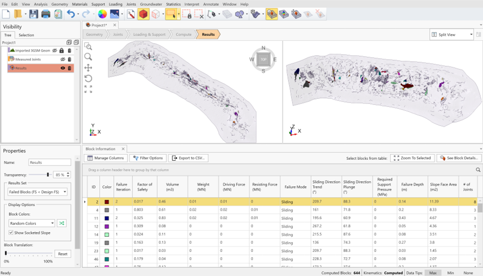
By highlighting these critical areas, engineers can quickly make proactive design changes, such as reinforcing vulnerable sections or adjusting support systems, before failure occurs. This foresight minimizes risks and ensures safer, reliable designs.
RocSlope3 and ShapeMetriX, Your New Dream Team
This new integration offers a smarter, more efficient way to work. ShapeMetriX and RocSlope3 can streamline your workflow and help you focus on analysis rather than manual processes. Seamless interoperability ensures data flows effortlessly from field collection to advanced modelling, so you’ll save time and encounter less errors.
This integration adapts to projects of any size, both small-scale site assessments and large mining operations, and whether you're designing safer slopes, analyzing failure zones, or evaluating support systems, this latest update ensures that your analysis is backed by reliable data.
