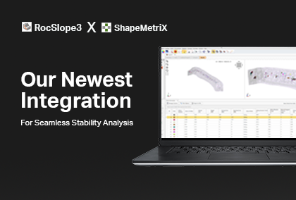
Together, ShapeMetriX and Dips Can Improve Your Rock Slope Stability Analysis
Wondering how to go from geological mapping to kinematic analysis seamlessly? That’s exactly what was covered in our webinar on the integration of ShapeMetriX and Dips, hosted in 2024.
Presented by Dr. Grace Huang, (Geomechanics Product Manager, Rocscience), with insights from Dr. Markus Pötsch (Technical Specialist, 3GSM) and Yalin Dogan (Application Engineer, Rocscience), the session explored how these tools work together to streamline engineering workflows.
Engineers working in rock slope stability, open-pit mining, and structural geology assessments can use this integration to capture, process, and analyze 3D geological data with greater accuracy and efficiency. Here are five key takeaways from the webinar that can help you optimize your rock slope stability analysis:
1. Capture More Useful Photogrammetric Data for Geological Mapping
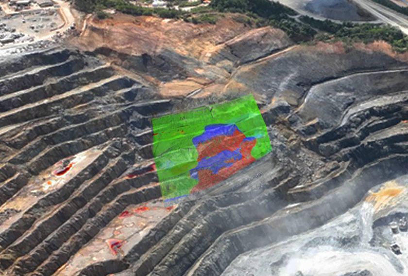
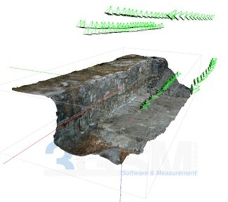
ShapeMetriX uses drone-based aerial photogrammetry and terrestrial imagery to generate high-resolution 3D models. But just top-down drone imagery is not enough for the task, as it can fail to capture critical discontinuities on steep rock faces. To generate a complete dataset, consider these techniques:
- Use a combination of nadir, oblique and face frontal images with evenly distributed camera positions to ensure a high-quality 3D model with minimal gaps is generated.
- Increase image overlap to at least 80% for better 3D model reconstruction.
- Don’t mix images with strong distance changes.
This approach ensures that your 3D model includes structurally significant features rather than just an approximation of the slope.
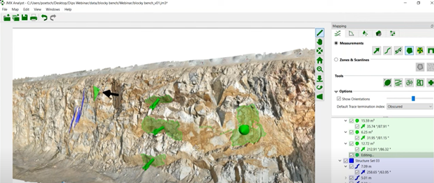
2. Use Semi-Automated Tools to Improve Joint Orientation Analysis
Conventional discontinuity mapping relies on compass measurements and visual interpretation, but this can introduce observer bias and inconsistencies between engineers. A more efficient and objective approach is to use semi-automated joint detection tools like Guided Trace and Region Grow in ShapeMetriX and stereographic projection and joint analysis techniques in Dips to streamline discontinuity analysis.
With ShapeMetriX, you can:
- Identify and extract joint sets objectively by clustering similar orientations in a structural geologic map.
- Quantify joint persistence, dip and dip direction, and spacing from high-resolution photogrammetric models.
- Minimize time spent on field surveys while ensuring consistent, reproducible results.
These measures will give you a structured dataset for further kinematic analysis.
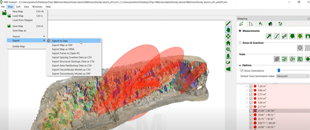
3. Directly Export Data to Dips for Kinematic Analysis
A common source of error in slope stability analysis comes from manually transcribing joint data from field notes into stereographic projection software, but the ShapeMetriX-Dips integration eliminates the need for manual data entry. Joint measurements are exported directly into Dips, where engineers can assess:
- Planar failure potential, based on discontinuity-slope alignment.
- Wedge failure mechanisms, using joint intersections.
- Toppling failure risk, by analyzing joint dip-slope relationships.
This automated transition improves workflow efficiency and reduces input errors for a more consistent and data-driven assessment.
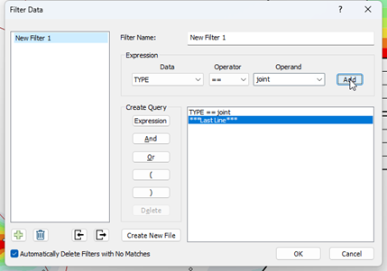
4. Use Filtering and Targeted Analysis in Dips
Large datasets may require selective filtering to extract relevant discontinuity data. The Dynamic Filtering feature in Dips allows engineers to refine analyses by:
- Isolating joint sets based on dip, dip direction, or persistence.
- Focusing on structurally critical features affecting stability.
- Applying real-time filtering to stereonets for targeted analysis.
This ensures that engineers work with geometrically significant discontinuities rather than processing irrelevant data.
5. Extend Analysis Beyond Kinematics
While kinematic analysis helps identify potential failure mechanisms, it does not account for joint strengths, external loads, or reinforcement design. To improve assessment accuracy:
- Incorporate joint shear strength properties to assess potential failure under different conditions.
- Model support systems (bolts, anchors) within the analysis to evaluate their effectiveness.
- Assess block stability under external loads by combining structural and geomechanical parameters.
A More Efficient Geotechnical Workflow
The ShapeMetriX-Dips integration represents a major step forward in geotechnical engineering, offering a data-driven approach to rock mass characterization. By streamlining the process of photogrammetric data acquisition, automated structural geologic mapping, and structurally controlled failure mechanism analysis, you can reduce manual errors, improve reproducibility, and accelerate slope stability assessments.
Not using our software yet? Download the trial versions of ShapeMetriX and Dips and integrate them into your workflows today!
Start Your Free Trial
More from Rocscience